The Proposed Project
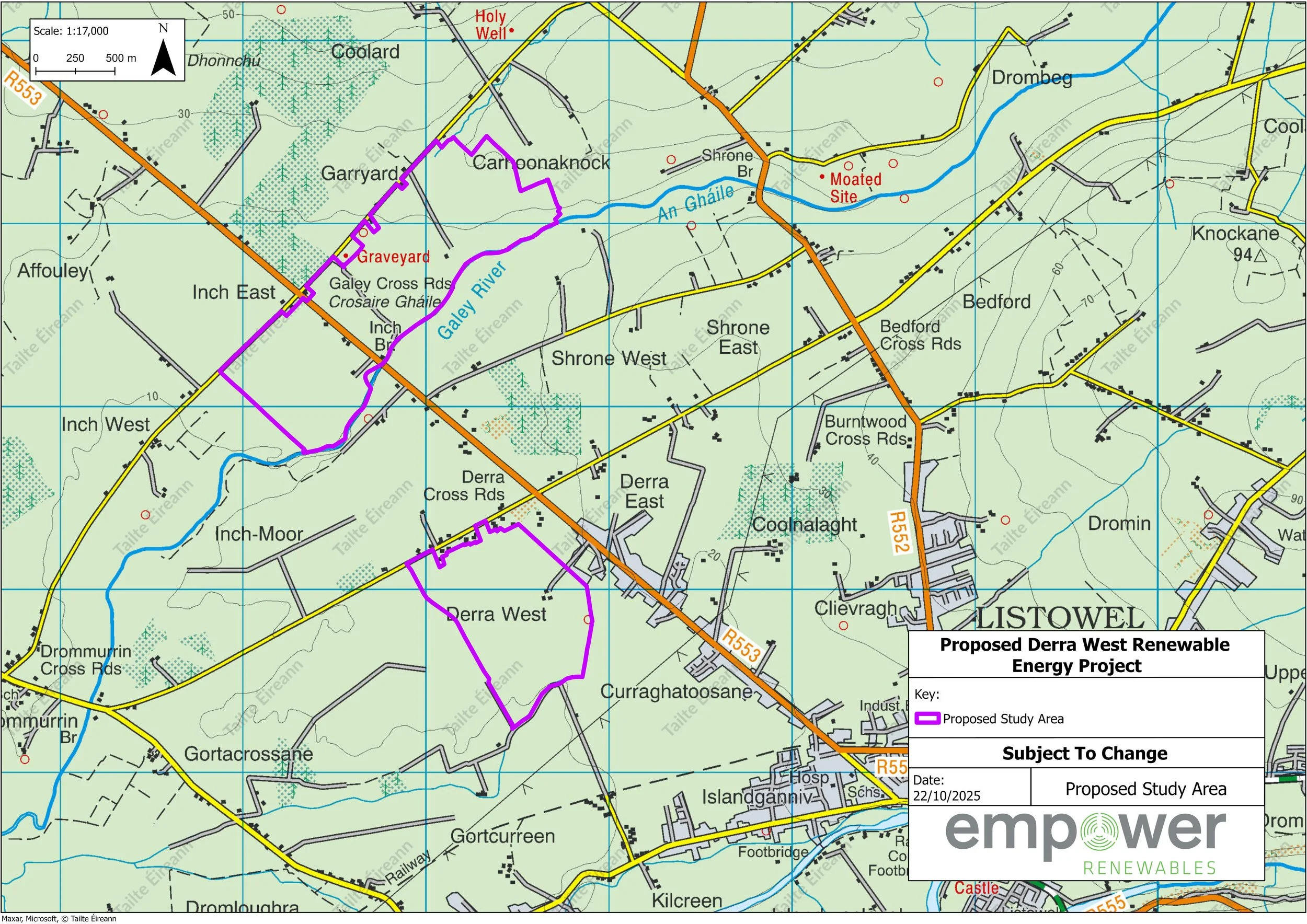
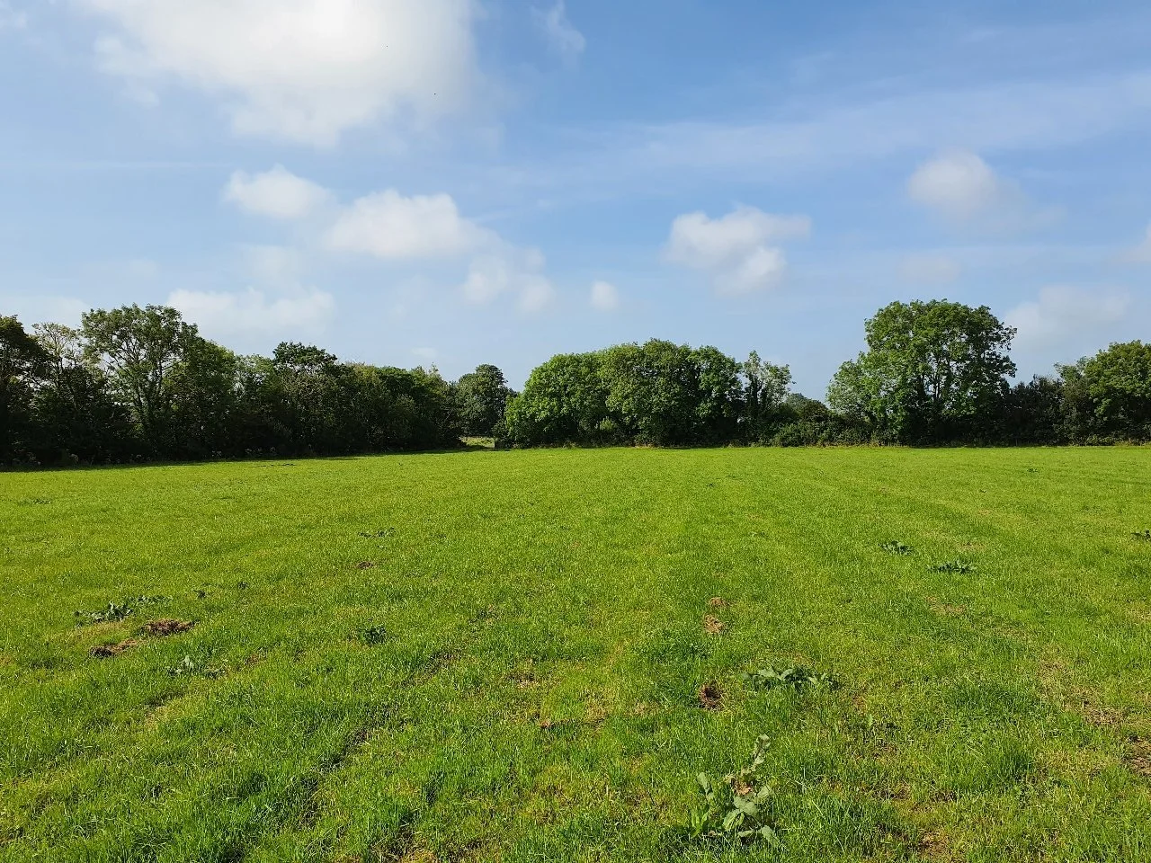
The proposed renewable energy project is located approximately 1.5km north of Listowel, Co. Kerry. The current Study Area comprises lands at Derra West, Inch Moor, Inch East, Coolard, Garryard and Carhoonaknock and measures approximately 180 hectares. The majority of the proposed Study Area is comprised of agricultural lands, improved pasturelands and cut-away bog. The Study Area is being considered for solar PV potential.
The Study Area for this proposed project has undergone a careful and rigorous site selection process which starts with a desk-based screening of the general area to buffer off all existing eircode's utilising the most recent eircode data, buffers off all designated environmental areas of importance, national monuments, existing and planned renewable developments, existing grid infrastructure, hydrological features and many more. Once areas of interest are established, we focus on areas with close proximity to grid.
As part of this project’s process, some initial ecology and bird surveys both within the Study Area and the surrounding landscape have also been carried out. This is done to help determine whether the area is in principle, suitable for a renewable energy project, pending further study.
The Study Area is not located within a Natura 2000 site i.e. Special Area of Conservation (SAC) or a Special Protection Area (SPA) or a Natural Heritage Area (NHA).
The Study Area benefits from close proximity to existing electricity infrastructure with suitable grid connection capacity.
The Kerry County Development Plan (2022 - 2028) supports the development of local renewable energy resources in accordance with the principles of proper planning and sustainable development.
The topography of the Study Area is mostly flat and well screened by existing hedgerows and trees.
Project Next Steps
A planning and environmental specialist have been working through the project assessments which are now in the final stages of compilation. The results of the survey data are being collated and will be used to finalise the various elements of this proposed project’s design. These environmental assessments will culminate in an Environmental Report (ER). The Environmental Report will describe all aspects of the proposed project and evaluate its potential effects on the receiving environment and the local community. The process ensures that any sensitive areas are protected throughout the project's design phase and that the utmost care is taken to minimise any potential negative impacts on sensitive receptors. The Environmental Report will form part of the planning submission to the consenting authority.
Environmental assessments include: landscape and visual, archaeology and cultural heritage, ecology, hydrology, noise, glint and glare, traffic management and many more.
Detailed grid connection options are also being assessed.
Background noise level monitoring has been completed and will form part of the studies to assess the potential impact that noise from the proposed project could have on the surrounding area.
A biodiversity management plan including additional bio-enhancement areas will be drafted to protect and support existing wildlife and increase habitat diversity.
Site investigation works will be carried out over the coming weeks to assess ground conditions.
The project team submitted a planning application to the consenting authority, Kerry County Council, in June 2026.
Study Area Map